EV03 TREE-LINED STREET
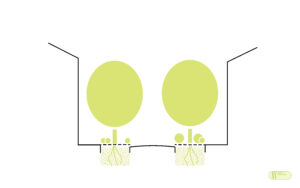
Tree lines on streets/roads in continuous tree pits

Aim
To integrate trees in the urban road system for the creation of connectors of the urban green infrastructure (UGI) primary system.
Why?
In terms of urban and landscape articulation, the tree-lined street is an archetype, a specific way to organise and qualify the urban fabric, providing the transition between the human scale and that of the built façades, visual connectivity and comfort. The services intended by treelined streets are:
► Urban landscape: Its greatest recognition can be found in important urban models such as promenades, boulevards or avenues.
►Liveability of public spaces: The tree cover contributes to the mitigation of urban heat island (UHI) effect by being an effective buffer and fixes pollutant particles.
►Ecological connectivity: The tree cover constitutes the main stratum for the ecological connection in the urban complex. The continuity of canopies facilitates the free movement and dispersion of fauna, mainly birds and insects. OFurthermore, vertical connectivity is ensured by the incorporation of the intermediate and lower strata.
►Water cycle: The existence of vegetation is necessarily associated with the presence of permeable surfaces, continuous or isolated tree pits, causing water infiltration and reducing runoff.
►Climate change adaptation and mitigation: Vegetation captures CO2 through the photosynthetic process.
►Circular economy: The existence of trees implies the generation of quality organic waste (green waste) for the production of other derivatives such as compost or mulch. The pit surfaces allow the incorporation of these products to the soil as an improvement or as a weed control mechanism.
How?
The tree-lined street is the area where most of the conflicts derived from the relationship between urban environment and nature take place. The integration of Grey and Green Infrastructure in the street requires a major effort of planning, design, implementation and management (maintenance).
In this solution, the tree appears as the basic structural element for the configuration of the urban fabric. It is a shade tree, never a mere ornament.
It is important to emphasize that the tree is a complex living being, composed of an aerial system, trunks, branches and leaves, and an equally hierarchical subterranean system of roots and radicles. The root system tends to occupy an area similar or superior to the crown projection, interacting in the urban space with the bases of the surrounding pavements. The roots need access to the moisture and nutrients of the soil; the leaves to the aerial carbon without which the trees cannot survive.
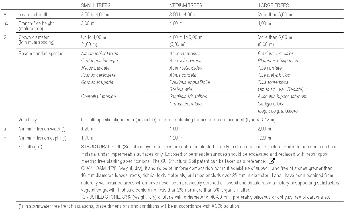
► OVERGROUND: The planting of trees in connectors of the Urban Green Infrastructure (UGI) Primary System will be carried out in continuous tip strips (minimum width 1,20 m). The tree size and its relationship with the facade should be taken into account, seeking relationships of scale and balance. In addition, the non-interference of the tops in their adult state must be guaranteed. The following table establishes the minimum dimensions that must be met in order to obtain a connector depending on the size of the tree.
►UNDERGROUND: In addition to aerial development, in the arrangement of the tree-lined street it is necessary to check the compatibility of the pavement subbase with the root development. It must be a base that stabilizes the pavement, stimulates the deep growth of the roots and does not interfere with the urban service supply networks. The best option so far is Structural Soil, a mixture of gravel and topsoil forming a Soil-Stone system. The following table sets out the minimum dimensions of the pit cavity and the characteristics of the pavement subbase.

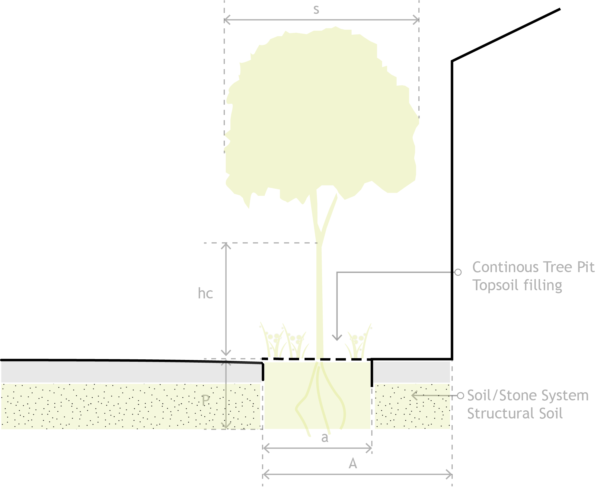
 SCHEME OF A CONTINOUS TREE PIT
A.- Sidewalk width
hc.- Branch-free height
(mature tree)
S.- Crown diameter
a .- Minimum trench width
P .- Minimum trench depth
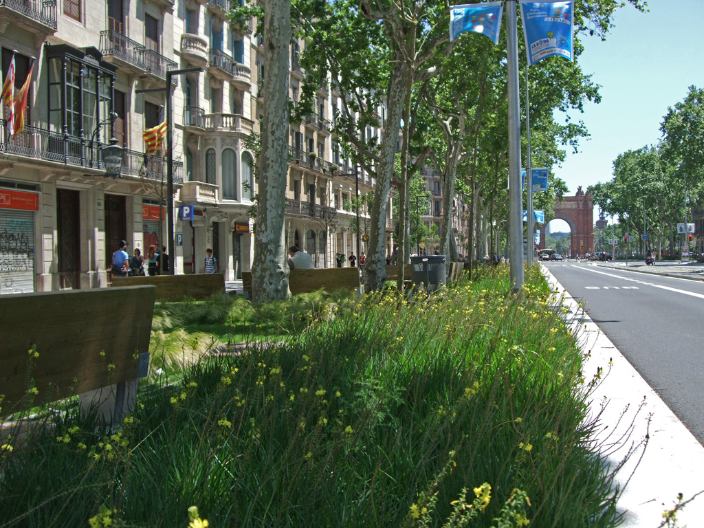
 Refurbishment of Passeig de Sant Joan
Barcelona (Spain), Lola Domènech Architect
city SCALE INTERVENTION

ISSUES AFFECTED
SUITABLE TO BE COMBINED WITH OTHER SOLUTIONS
MEASURE METHOD
Indicator
(I1) CO2 Capture (CaCO2)
Unit
(I1) T CO2 / year
Minimum goal
(I1) 0,03 T CO2/m · year (minimum density 0,20 trees/m)
Desirable goal
(I1) Maximum possible tree density depending on the specific
characteristics of the road/street.
Measurement method / Formula
(I1) CaCO2 (T CO2·year) = [A x B]
A: number of trees in the street
B: average capture value (0,15 T CO2/tree·year)
PLANNING LEVEL
Regional planning
Urban planning
Natural resource management plans
people INVOLVED
Local government technicians
Regional/General administration technicians
Water and natural resource managers.
POSIBLE ACTIONS DEVELOPED BY THE ADMINISTRATION :
• Urban tree master plan coherent with the management and planning instruments of the urban green infrastructure (UGI).
• Urban landscape ordinance referring to trees as an element for urban development.
• Municipal nursery.
What should we consider for its implementation?
• The selection of the type of vegetation has to be adapted to the specific conditions of each space (efficiency, pollution capture, flexibility, resilience and adaptation, etc.)
• Over and underground functional requirements cannot be ignored (space, infrastructure and materials).
• Safety in the use of roads/streets is paramount, ensuring the compatibility of the different modes of traffic and the visibility of traffic lights and signs.
• The passage of time must be taken into account to foresee formal and aesthetic results. The objective is to maintain a minimumbalance between the natural structure of the trees, their age
and the space available. Maintenance, particularly pruning, will influence the achievement of this balance.


