AG01 NATURAL DRAINAGE NETWORK
Rainwater drainage network through
nature-based systems
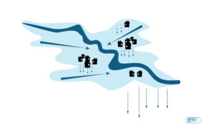
Aim
Improve the integral management of the water cycle.
Why?
Because we need an integral management of resources, not their consumption.
We must consider the effects of climate change starting with the design processes of urban planning, in order to moderate the rise in the planet’s temperature and the waste of energy and water resources, developing a catalogue of multi-scale, flexible and low-risk solutions.
The Spanish National Plan for Adaptation to Climate Change (PNACC) indicates a general trend towards higher temperatures and less rain, which will produce:
·General reduction of available water from 5 to 14% by 2030 considering a temperature increase of 1ºC and a drop in precipitation of 5%, which could increase to 20-22% by the end of the century.
· Hydrological variability, simultaneously increasing the risk of torrential episodes and floods, which will diminish the quality of raw water and generate risks for the quality of drinking water even with conventional treatment, due to the factors that interact: increased temperature; increased loads of sediments, nutrients and pollutants due to heavy rains; greater concentration of pollutants during droughts; and interruption of the operation of treatment facilities during floods.
How?
Through urban-hydraulic landscape infrastructure whose mission is to capture, filter, store, retain, transport and/or infiltrate the water to the land, so that it does not suffer any deterioration and even allows the elimination/purification, in a natural way, of at least part of the pollutant load that may have been acquired by previous urban runoff processes.
This approach attempts to reproduce, as faithfully as possible, the natural hydrological cycle prior to urbanization, so that we can better manage the problem of water scarcity (drought) or surplus (flooding) in urban environments.
This kind of strategies are named Sustainable drainage systems (SuDS). They operate on different parameters:
► Advantages for the user:
• Improvement of urban spaces for people and nature, helping to avoid the heat island effect.
• Reduction of energy consumption
• Improving air quality and health
• Increased value of land and property
► Advantages for the public administration:
• Control of runoff and flood risk
• Increase in the volumes of rainwater reused: less consumption in the treatment/supply of drinking water.
• Reduction of the load on WWTPs: less consumption in transport/treatment.
• Improved quality of runoff: less consumption in treatment.
• Regeneration of degraded areas
► Advantages for the environment:
• Regulation of the hydrological cycle
• Better adaptation to climate change
• Prevention of surface water and groundwater pollution
• Increasing biodiversity
• Improved soil quality
Separate network diagram
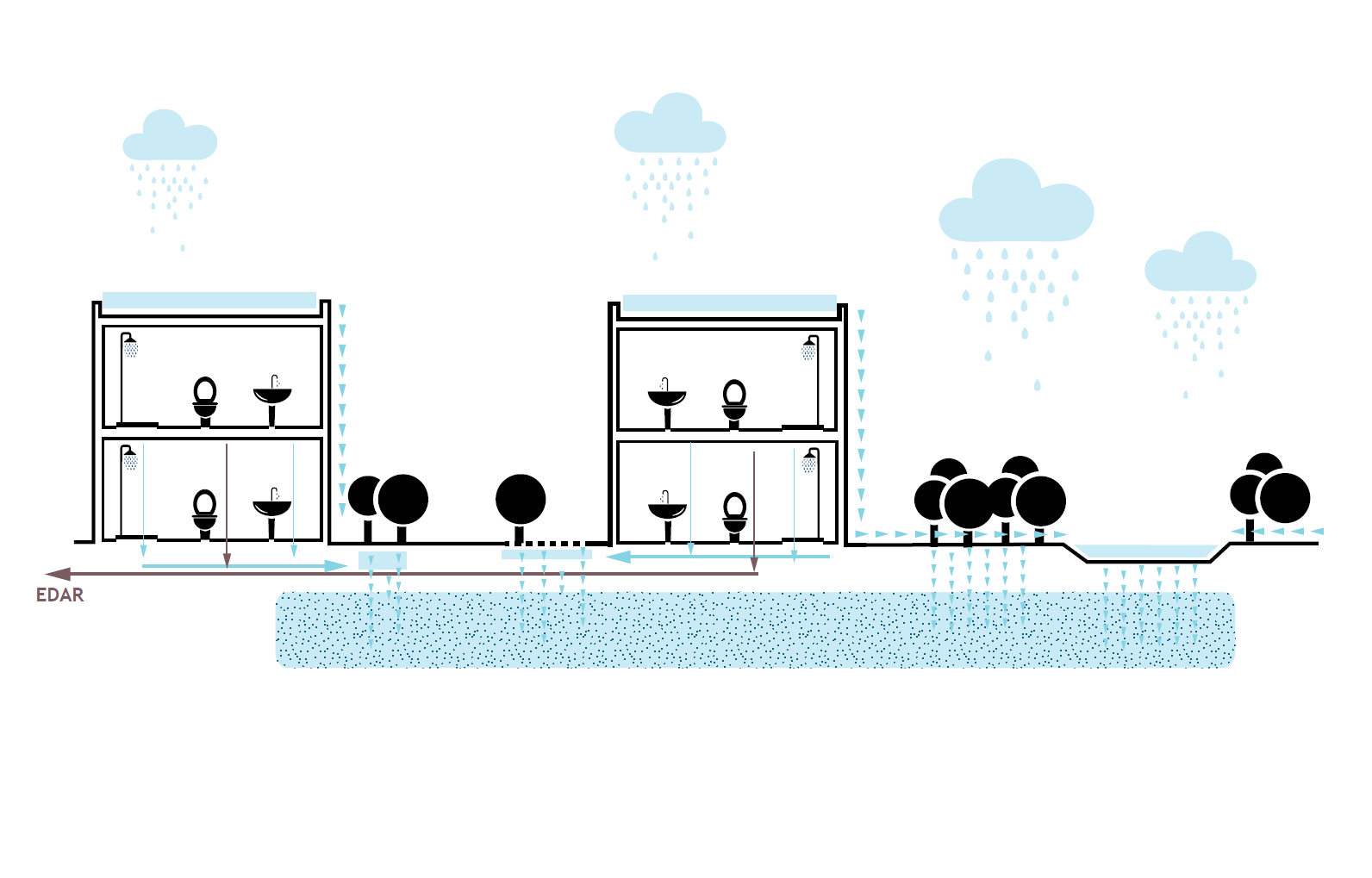
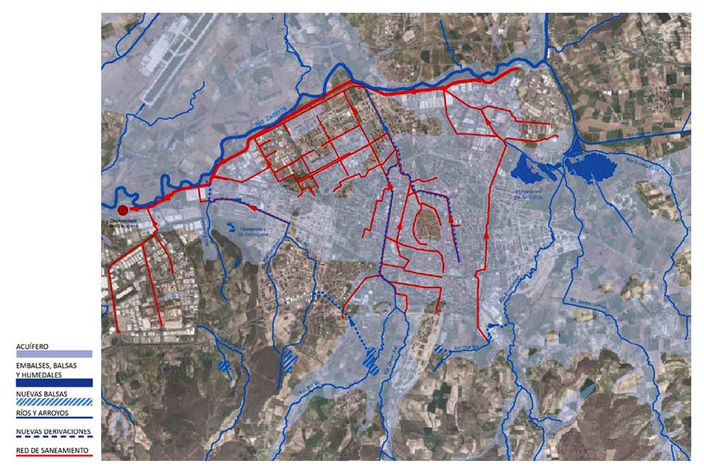
Diagram of separative and recovery network of watercourses in Vitoria. Source CEA (Environmental Studies Centre of the Vitoria-Gasteiz Town Council)
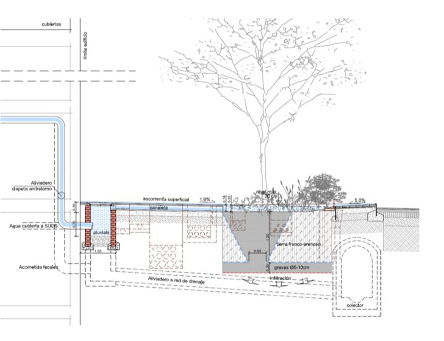
Transformation of a single sanitation system into a separate one using SUD solutions.
Source: Marina del Prat Vermell Development Project. Barcelona. First Phase. ESTEYCO.
City Scale Intervention

ISSUES AFFECTED
SUITABLE FOR COMBINING WITH OTHER SOLUTIONS
MEASURE ELEMENTS
Indicator
Strategic action
Secondary Indicator
% of metres of separative network / metres of unitary sewerage network
Unit
Percentage
Minimum goal
50% Separative Network Coverage
Desirable goal
100% Separative Network Coverage
measure method / formula
(I2) = [A / B] x 100
A: Separative network length
B: Total network length
PLANNING LEVEL
Regional planning
Urban planning
Natural resource management plans
AGENTS INVOLVED
Local government technicians
Province/General Administration Technicians
Managers of natural spaces or water resources.
Possible actions promoted by the administration
• Turn public centres into places of “good practices”, as an example of efficient use of water for the rest of the citizenry.
• Replace as many m3 of drinking water as possible with water re-used with tertiary treatment.
• Develope a database on user characteristics, consumption and available facilities.
• Minimize breakdowns through good maintenance.
• To draft a regulation that incorporates items related to saving and efficiency in the use of water.
What should we consider for its implementation?
• The dimensions and characteristics of the existing unitary network
• The topography of the land (micro-basins)
• Soil composition (permeability index, existence of polluting elements – former urban/industrial landfills -, risk of landslides or modification of the foundation conditions of the building or infrastructure, etc.).
• Watercourses, lakes, groundwater or other elements that may be receptors of urban runoff.
