TR01 SOLUTIONS INTEGRATION
To integrate the solutions on the different networks. How an intervention in a new development is related to the existing urban environment.
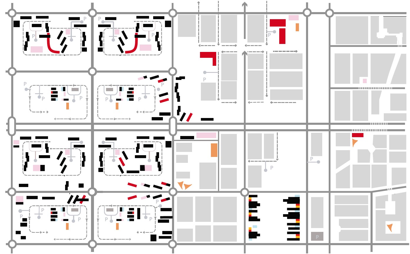
BIOCLIMATIC URBANISM
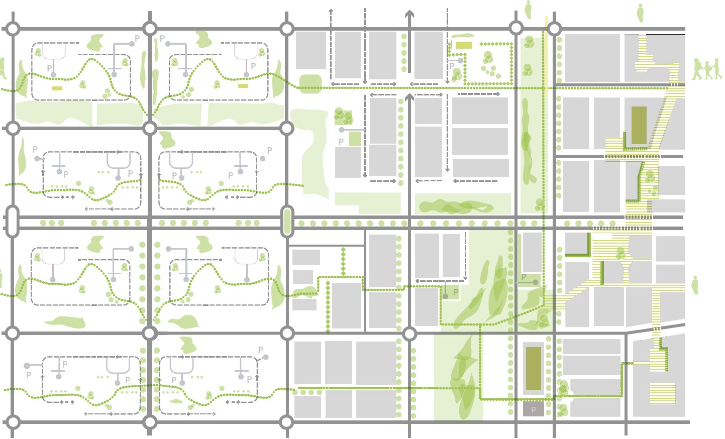
CONDITIONER GREEN SPACES
ACCESSIBILITY
WATER CYCLE
CITY SCALE INTERVENTION

ISSUES AFFECTED
Aim
Any intervention that seeks to be sustainable cannot be a construction alien to the existing immediate environment. The implementation of solutions that have to do with infrastructures or service networks must set a guideline for the transformation of the city, so that they must recognise the problems and advantages of the pre-existing and nearby spaces in order to prepare for their integration and continuity.
For this reason it must be in accordance with the historical development of the city, adapting to the urban fabric and the natural spaces of its surroundings. Its form and structure cannot be determined solely by the technical requirements of sustainable technology, but must be sensitive to the history and structure of the city, reinterpreting its growth patterns and adapting to its networks. It is an added value to have any intervention as part of a network of interventions in the city.
How?
In order to achieve a growth of the city in accordance with the physical pre-existence, both on a geographical scale (morphology of the soil and subsoil, riverbed and river basins, aquifers, vegetation cover, contaminated soil, etc.) and on a crystallised scale throughout the historical construction of the city (urban morphology, sanitation networks, public transport system, land use, facilities, green areas, etc.), it is necessary to have a precise knowledge of the existing in the place of action and the requirements of the population, as well as to have an overall view.
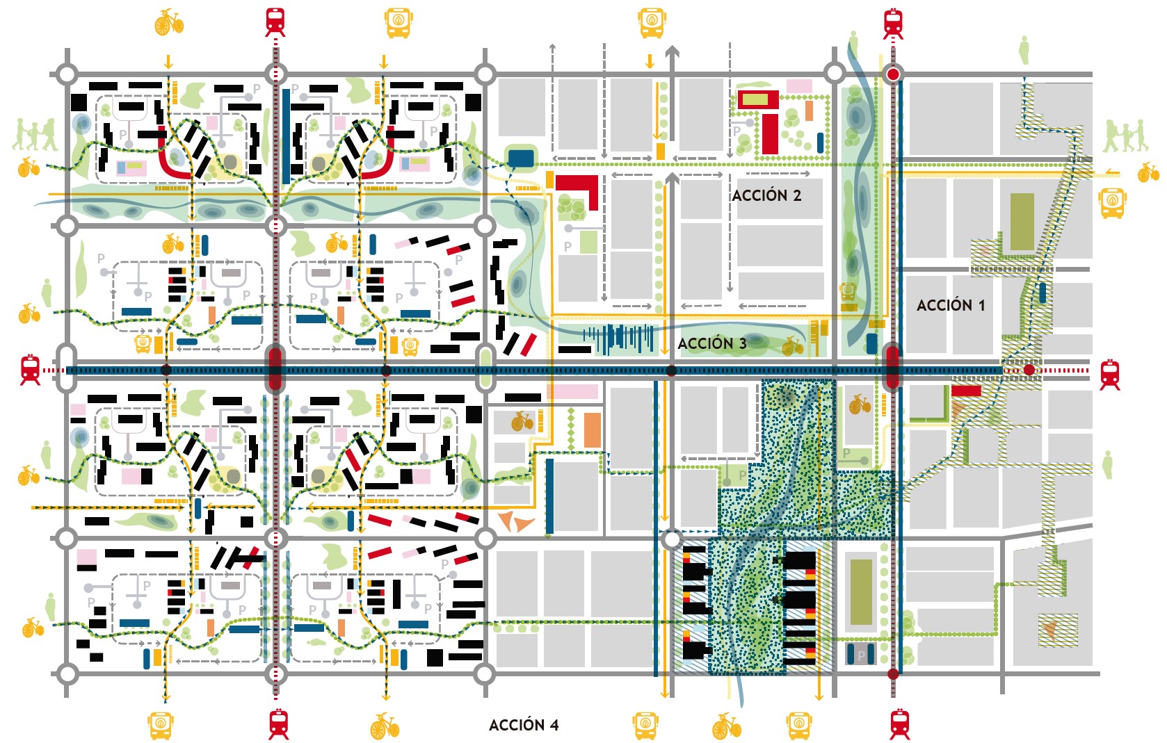
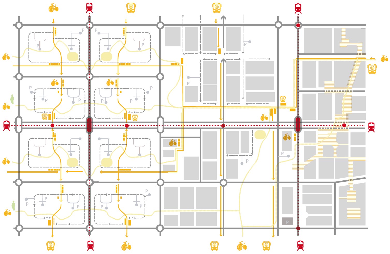
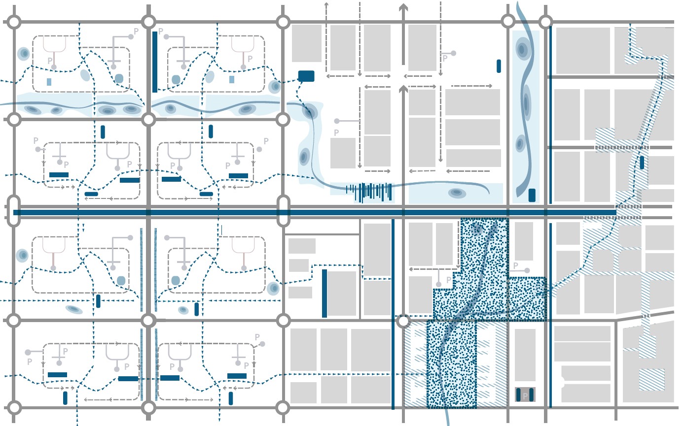
The graph shows some possible coordinated actions to relate an intervention in a new development with the existing ones:
► Action 1: Redevelopment of historic areas
The pedestrianisation of a central axis within the consolidated city, where squares, inner streets of blocks are concatenated, makes it possible to jointly propose solutions linked to the water cycle ( permeable pavements, water tanks, recovery of underground runoff as elements of the urban space, etc.) and to the conditioning of green spaces (landscaped terraces, green walls).
► Action 2: Construction and re-urbanisation of pedestrian routes. Safe school routes
The location of school facilities, in relation to the existing ones and to the natural structure of the terrain, the rearrangement of the traffic of the existing networks, allows for the construction of continuous pedestrian itineraries. These routes can be the object of consecutive projects of permeable paving and recyclable materials, revegetation, plant fences and slopes of school equipment, or the implementation of water collection and accumulation systems.
► Action 3: Recovery of riverbeds as part of public space systems. Coordinated design of the green space network, the rainwater drainage network and clean mobility itineraries (pedestrian, cyclist, electric buses and tram).
► Action 4: Hierarchisation of the existing road and design of the public transport network.
Jointly designing the network of spaces and public transport (existing and new), allows to propose coordinated solutions of multimodal stops (bicycles, bus, metro) in relation to the green structure spots (urban forests, river parks, pedestrian itineraries), and the existing uses. By planning them together, for example, bus stops can be suitable areas to locate water reservoirs for cleaning and maintenance of gardens, or tracks in sports areas and educational centres to retain water from runoff in relation to cycling/pedestrian and transport itineraries.

